The development proposals for the region would have to improve the living conditions of the local population. No substantial immigration from other areas was expected. In order for the proposals to be accepted by the local population, their benefit from the proposed development had to be clear.
The project involved the identification of: 1) areas for exploitation and development of natural resources; 2) areas suitable for the conservation of the natural ecosystem; 3) analyses of crops to be cultivated that would suit the characteristics of the region. The La Mojana Pilot Project was to be carried out in four phases: 1) initial study and planning of field studies; 2) design, construction and implementation of the pilot areas for research; 3) field research; 4) evaluation and results.
Among other things, the research would have to pay due attention to agriculture with high external inputs and sustainable agriculture with low external inputs. The first two phases of the project would initially have to be realised during that time. Three components could be distinguished, namely: 1) determination of homogeneous areas; 2) planning and location of the test areas; 3) design of the test areas.
At the request of a Dutch consulting firm that had been commissioned to realize the project, together with a Colombian consulting firm, I became involved in this project, based on the experience of the IJsselmeerpolders Development Authority with this type of projects and the fact that the Colombian representatives wanted someone from the Dutch government to be there. Together with an employee of the consulting firm, I left for Bogotá, Colombia, at the beginning of July 1994. The first few days we worked in the office of the Colombian consultant, we received the relevant information about the area, we had the necessary discussions and we reached agreement on the approach and design of the project.
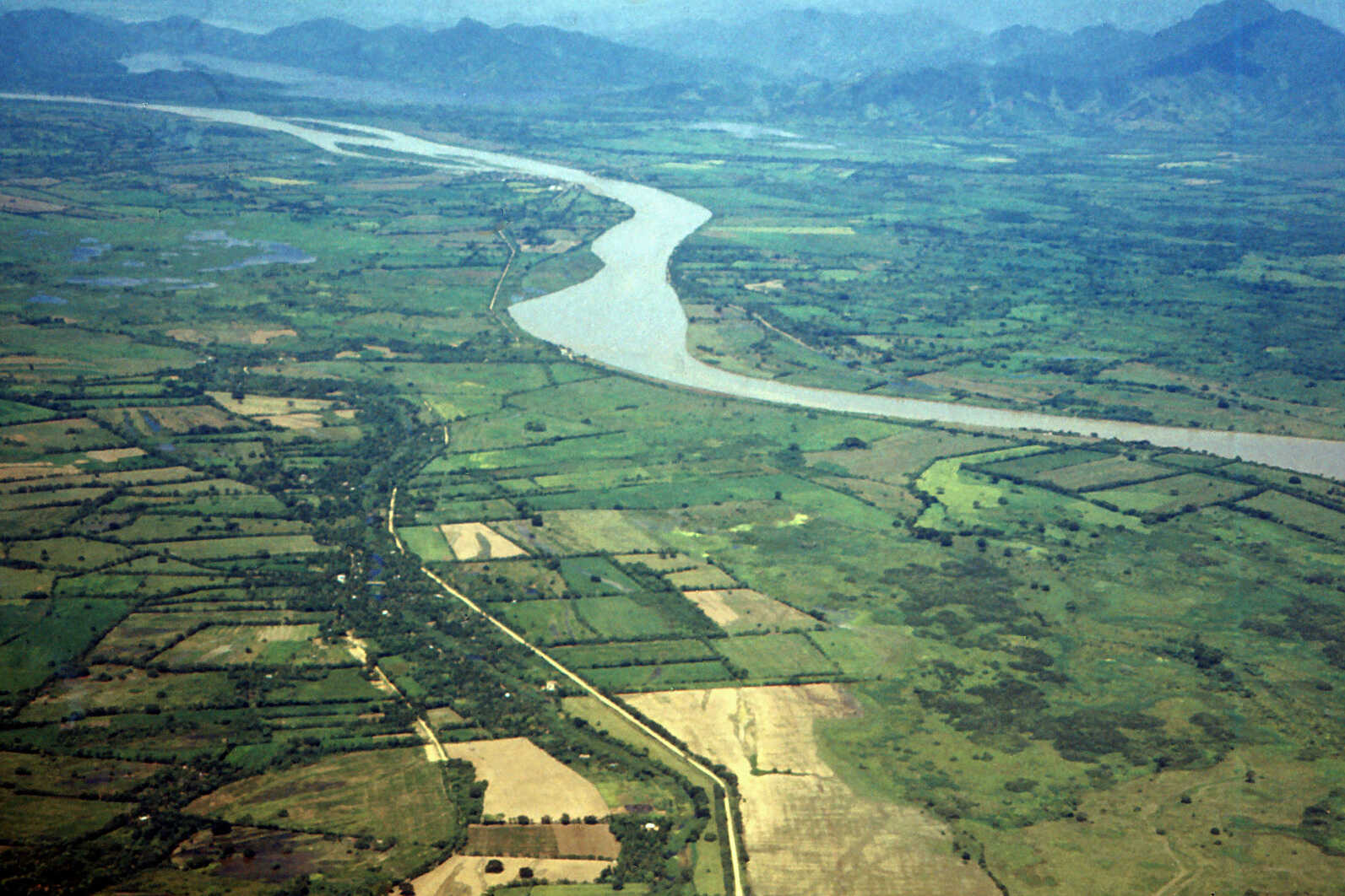
After a few days I asked when we would go and look in the area and what the interesting points would be. My Colombian counterparts looked at me somewhat surprised. It turned out that we could not go and look in the area at all because there were four narcotics groups (narcos) that might not appreciate our arrival. We could fly over the area, but not lower than 1500 metres, because otherwise they could shoot at us. We then put in the report that the area would have to be sufficiently safe before development could start.
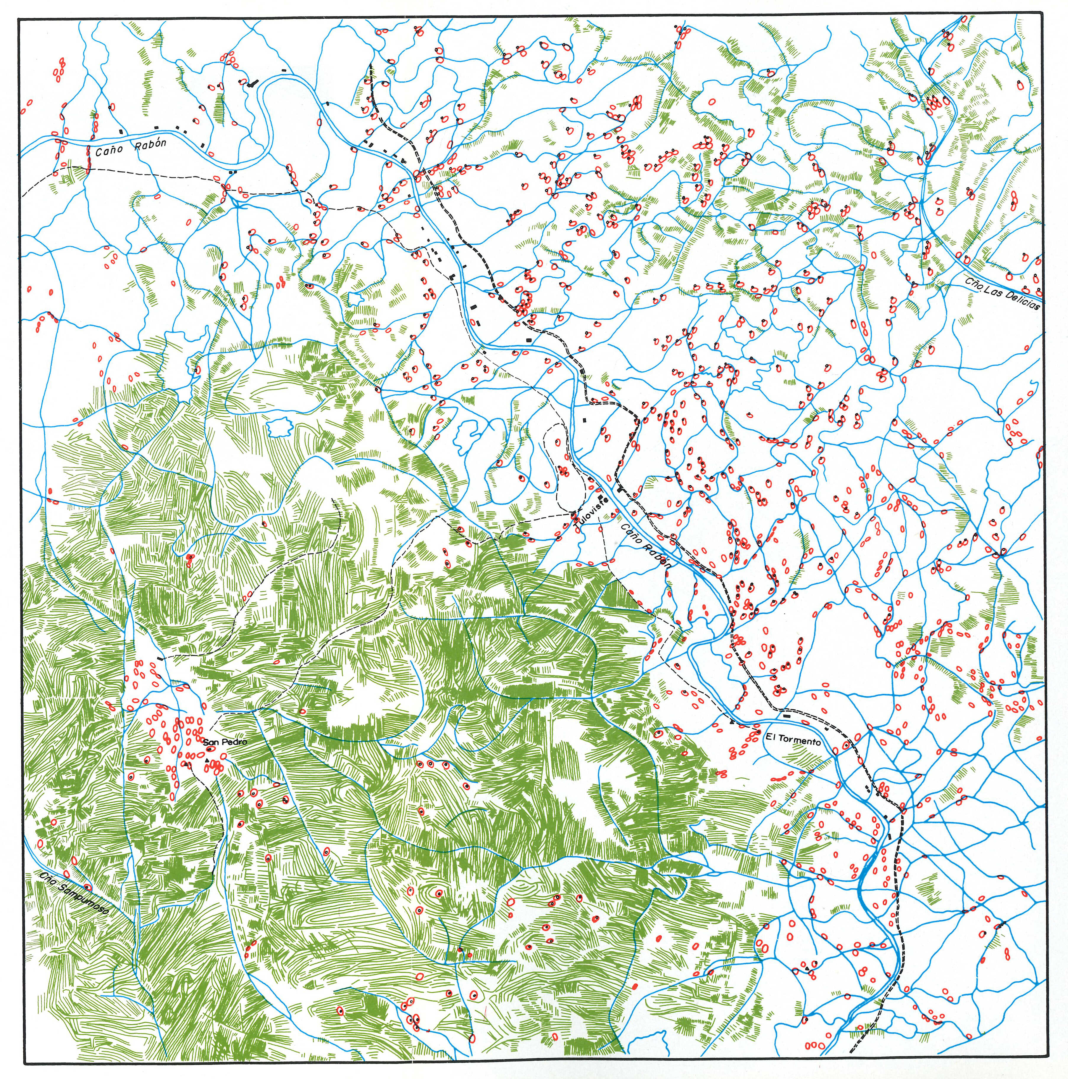
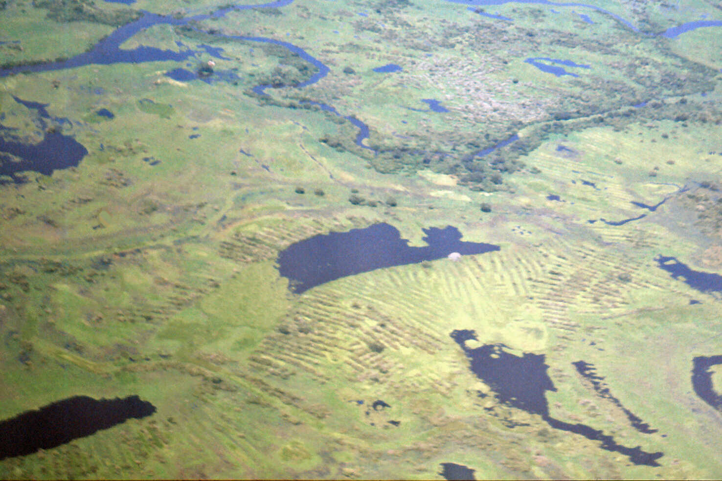
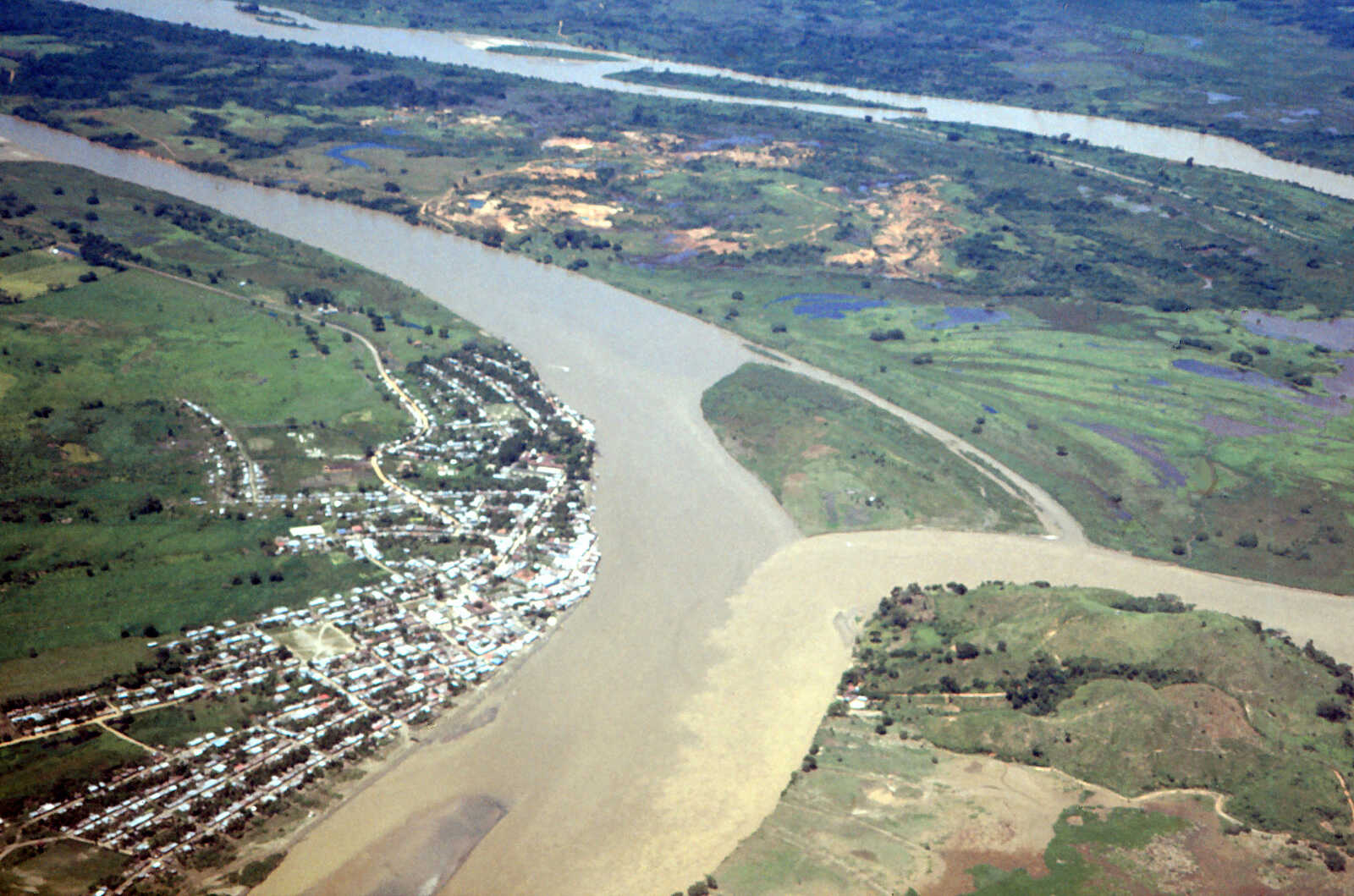
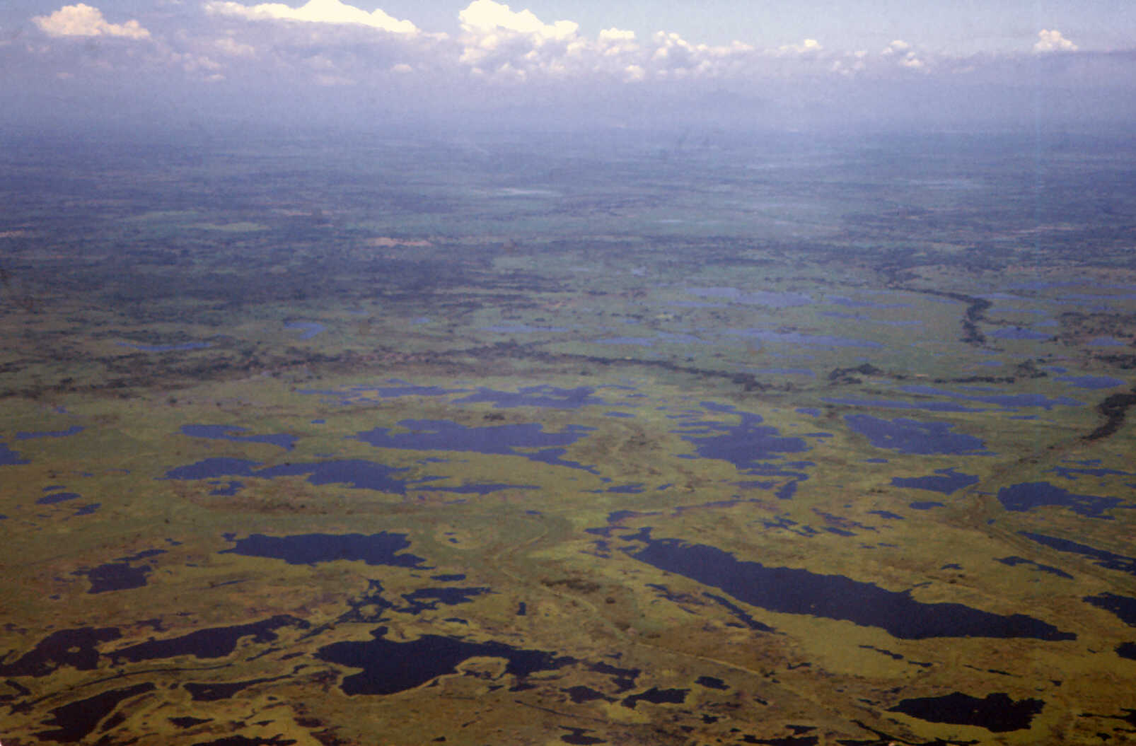
A few days later we flew high enough over the area in a small plane. We saw a kind of inner delta, which was bordered on all sides by large rivers. The delta consisted of various lakes and watercourses, a lot of nature reserve, a few villages and small-scale agricultural areas. In a few places we saw a kind of elongated ridges with water in between. I asked what this actually was. It turned out to be remains of the old Zenú culture, which had existed between approximately 200 BC (before Christ) and 1600 on the transition between water and land. Very interesting. In Bogotá there appeared to be a Zenú Museum. So I visited it. In short, the sightseeing flight was very informative, especially since we could not enter the area by car or boat.
Back in Bogotá we set to work gathering more information and drafting our report. The report had to be such that decisions on the location and shape of the test areas could be made on the basis of it.
There was no real plan for the development of the region and only limited information was available on quite a few aspects. Due to the physical circumstances there were large differences that could be important for different types of development. The different types of land use, the questions and the possible developments that the project would have to initiate, required a varied approach to the project. In order to have a good development framework we proposed to make at least a zoning plan. In order to realize this we proposed the necessary additional studies on the physical situation, forestry, potentials, limitations and interactions in nature conservation and the socio-economic situation. For all these studies the collection of field data was of great importance, and that was not an easy task given the security situation.
We distinguished the location and size of the test areas, the design of the field studies and the other studies to be carried out. For the test areas and the field studies, we took into account a distribution over the region within the physical possibilities and limitations, and formulated a preliminary proposal for their location. In total, we proposed five test areas to conduct research on the following subjects: 1) agriculture under average rainfall conditions; 2) agriculture under intense rainfall conditions; 3) livestock farming; 4) fish farms; 5) reintroduction of the Zenú agricultural method. The proposed test areas together covered approximately 150 hectares.
The experiments in the field studies had to be carried out in close cooperation with selected farmers or fishermen. The following field experiments were proposed: protection of crops against flooding, water saving for crops in the dry season, possibilities of drainage, cultivation of high-yielding grasses and cage cultures for fish farming.
Pollution was a serious problem in the region. This pollution was mainly caused by pollution in the rivers that was caused upstream. This pollution could only be reduced if the Central Government would develop and implement rules and regulations for this. In the region itself, agriculture would have to be developed in such a way that pollution from leaching of fertilizers and pesticides would be kept to a minimum.
There could be several other development possibilities than those currently under consideration. Some of them, such as recreation, would become possible if the security situation improved. For some others, such as special cultures, the information was not available to determine their feasibility. We recommended that such possibilities be investigated further.
After two intense weeks we delivered our report. In the context of this story I looked at Google Earth again. Unfortunately the images of the area are not very clear. The impression is that not much has come of the intended development.