The expectation in 1993 was that the rise in the water level would slow down or even stop, that in 10-20 years the water level would most likely not be higher than 26 metres below MSL and that the water level would then slowly continue to rise due to climate change. At the water level of 27 metres below MSL the surface area of the sea was 390,000 square kilometres, almost ten times the surface area of the Netherlands.
The unexpected rise in water levels since 1977 had caused major damage along the banks. In the context of cooperation between Kazakhstan and the Netherlands, in June 1994 I visited Kazakhstan with three colleagues of Rijkswaterstaat to examine the problems and discuss proposals for improvement.
We started with a briefing in the capital Almaty and then flew to Atyrau, north of the Caspian Sea, where we received more detailed information from the local authorities. In the coastal zone there was oil production and related industry, as well as factories for processing caviar and fish, the cities of Aktau (population 300,000) and Atyrau (population 160,000) and a concentration of settlements in the Volga Delta, infrastructure, pipelines, very extensive agriculture and natural areas. A special feature was the nuclear power plant in Aktau, which generated electricity for the western part of Kazakhstan.
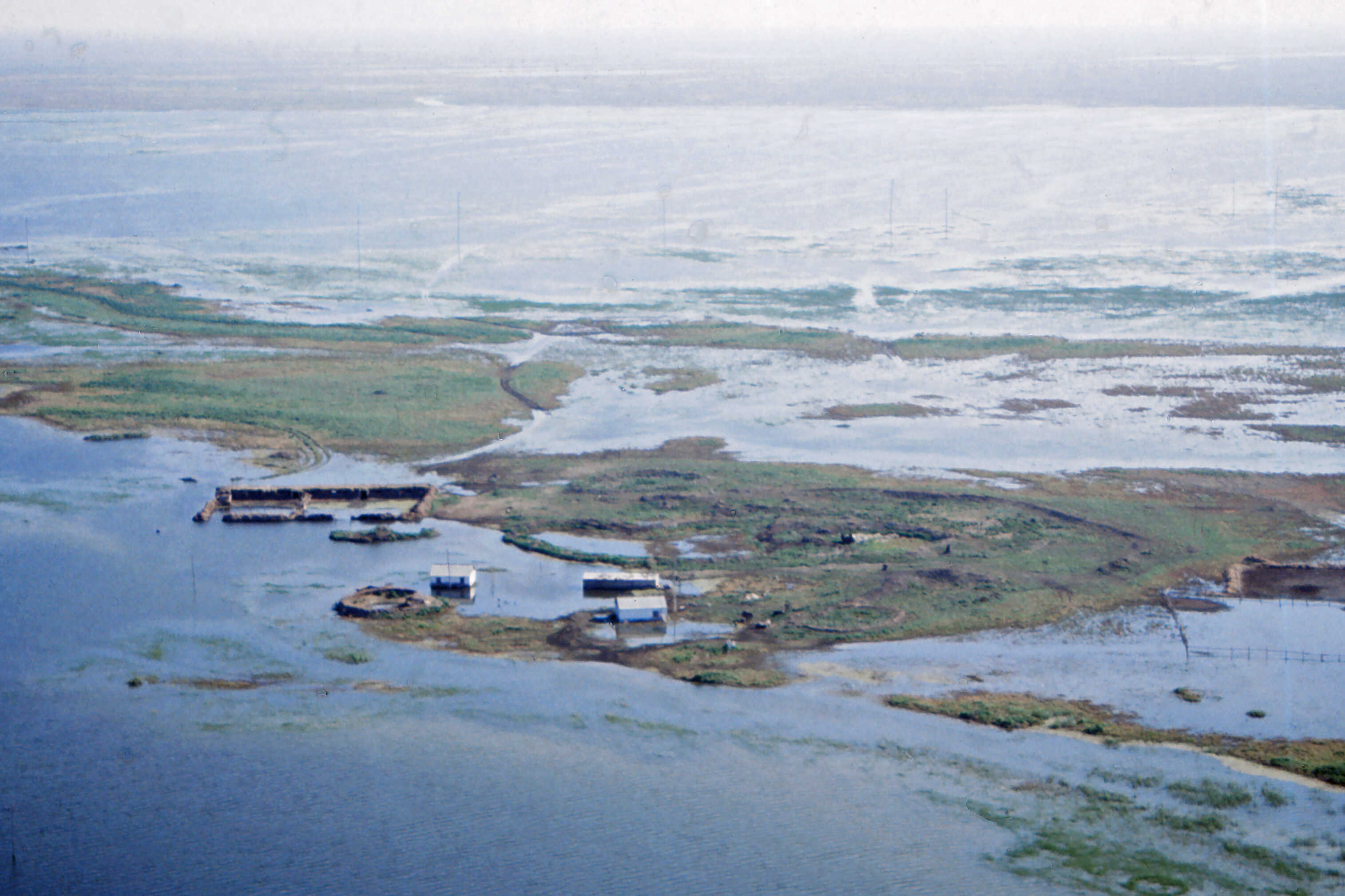
Oil production played and plays an important role in the economy of Kazakhstan. However, several old oil production areas from the time of the Soviet Union were subject to temporary or permanent flooding during our visit. Temporary dikes were built to protect these areas. Atyrau was subject to flooding from the Caspian Sea and the Ural River. Part of the rail and road network, as well as the Atyrau airport, also suffered from flooding. Extensive agriculture mainly involved cattle grazing in the large plains. The extremely flat area had steppe vegetation. Only on the banks of the Ural River there were trees.
Several dangerous situations could be distinguished with regard to the extreme river discharges and the rise in the water level of the Caspian Sea:
- most damage was expected from the old oil fields along the Caspian Sea. These fields were threatened by flooding or were already flooded, causing major environmental damage;
- the water of the Ural River was polluted and the sediments at the mouth of the river were probably also polluted;
- the nuclear power plant at Aktau used cooling water from the Caspian Sea. If this plant were to be flooded, the electricity supply to western Kazakhstan would be endangered. Some measures had already been taken to protect the plant against such flooding.
The designed and partly constructed emergency dikes along the Ural River and the Caspian Sea coast were short-term emergency measures. Under extreme conditions, these dikes - mostly sand dams - would certainly break. Therefore, permanent solutions for the protection of the coastal zone had to be realized as soon as possible. The government of Kazakhstan had a plan to build a huge dike along the entire coastal strip to protect the coastal zone. This dike would consist of a core of sand and a stone revetment. A major problem was that stone for the revetment was difficult to obtain in the area around the Caspian Sea and the supply of it from other areas would be very expensive.
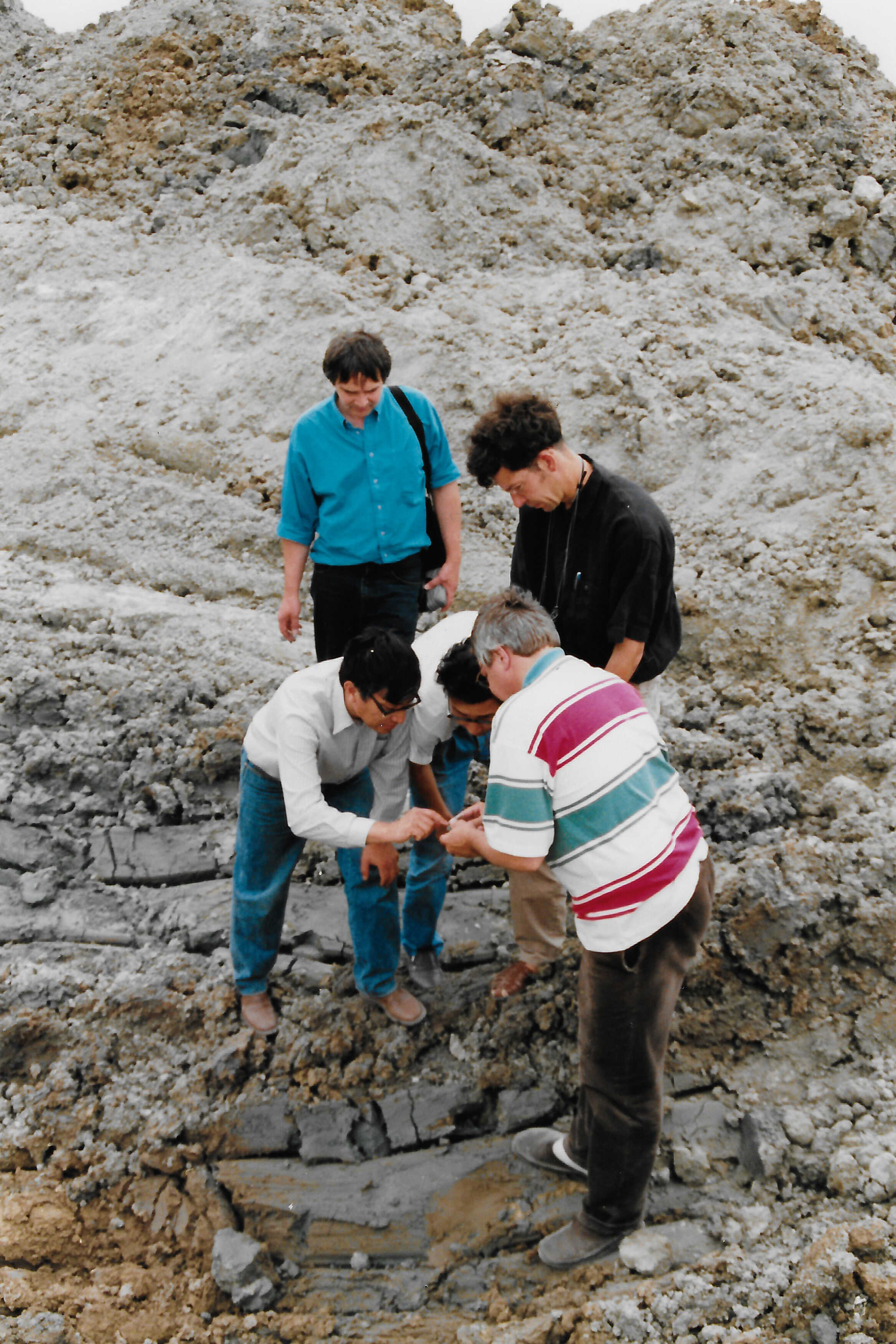
We flew in a helicopter over a large part of the coastal zone and landed at some interesting places. We also visited a huge new oil extraction site, because there was a lot of oil under the area. The new installations looked excellent. A complete contrast to the old abandoned oil extraction areas from the Soviet era. We flew long stretches over a completely empty and flat landscape. We also drove a stretch through the partially flooded area along the Ural River. In short, excellent information in a few days. In the evening we discussed what was our impression of it.
The main water supply to the Caspian Sea comes from the Volga River, which on average annually discharges an amount of water equivalent to a water layer of 75 centimetres on the sea. The average annual precipitation on the sea is 19 centimetres. In addition, there is some supply from the Ural River and a few smaller rivers. The largest discharge is caused by evaporation from the sea, which on average annually removes a water layer of more than 1.1 metres. Because, as mentioned, the shore is very shallow, the surface area of the Caspian Sea increases considerably with a rise in the water level. For example, at a water level of 29 metres below MSL the surface area was 360,000 square kilometres and at a water level of 27 metres below MSL it was about 30,000 square kilometres larger, say almost 10 percent. The different surfaces cause different amounts of evaporation. This mechanism forms an important stabilizer for the water level. Therefore, caution had to be exercised when constructing dikes, land reclamations and damming bays. If large areas could no longer be flooded, evaporation could not increase and the rise in water levels would not be reduced.
Measures to solve the problems with regard to the water level in the Caspian Sea could in principle be divided into measures on a local scale and short term to large scale and long term. It was important to determine on a national scale which areas had to be protected and which areas could be flooded in the event of a rise in the water level. In an international context, it was important that the countries around the Caspian Sea would make agreements about the surface area in each country that could be flooded in the event of a rise in the water level. The question was whether the gigantic dike along the coast was such a good plan, or whether there could be better alternatives.
In the search for the best solution, the following had to be considered: oil production areas, urban areas, industrial areas, infrastructure, pipelines, very extensive agriculture and the natural area. For the oil production areas, the advantages of flood protection were obvious and essential. For the industrial areas and the main infrastructure, more or less the same applied. For the urban areas, the people had to be protected from the water and damage to houses, roads, shops, offices and industries had to be prevented. Because of the very extensive agriculture, it would not be necessary to protect the agricultural lands against flooding by the Caspian Sea. This was all the more important because, as mentioned, the flood prone areas played an important role in increasing evaporation and thus in regulating the water level in the Caspian Sea. We therefore came to the conclusion that it would be very important to protect the above-mentioned areas, infrastructure and pipelines, but not the extensive agricultural area and the natural area. In our opinion, the huge dike was therefore not a good solution.
We flew back to Almaty, where we were to present our findings. The presentation took place in a room at the Ministry where there appeared to be about two hundred people. I presented our findings with the help of an interpreter. When I said that we believe it is important that the valuable areas should be protected, but that the areas with extensive agriculture and the natural area should not be protected, several people in the audience started to nod in agreement. I thought, that it was going well, until someone in the middle of the room, who apparently understood English, raised his hand and said: ‘That's not what he said at all.’ It turned out that the interpreter had not translated what I said, but had reported that we fully agreed with their plans. Then the man who raised his hand explained what I had said and a huge discussion ensued among the audience. Of course we could not follow that, but in the end it turned out that they understood what we were proposing and could even agree with it.
In the years that followed, I regularly met our counterpart from the Ministry at international meetings. Of course, I always asked him how things were going with the Caspian Sea. The enormous dike was indeed never built, oil is being extracted on a very large scale in the area, with everything that goes with it. A few years later the water level in the Caspian Sea gradually started to lower again. The level is now about a metre lower, 28 metres below MSL.