I was allowed to contribute to it about the role of the Dutch in land reclamation projects abroad, with special attention to the role of the employees of the RIJP. This contribution is based on that, as well as on a number of developments that have taken place since then.
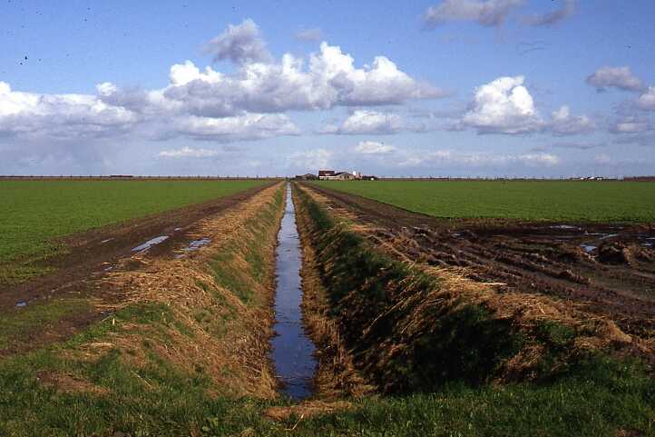
Characteristic of polders is that these areas are unsuitable for habitation, agricultural exploitation, urbanisation, etc. without artificial water management in the form of water management aimed at storing and discharging of excess water and flood protection, possibly combined with irrigation. The drained lakes, to which the IJsselmeerpolders in the former Zuiderzee must be included, are the clearest example of this, since drainage by pumping was necessary here right from the start. In this article I will give a brief characterization of the polders in the world, as well as the place that the Zuiderzee Project has among them.
Polders have been constructed all over the world in different climates, below sea level, but also far above it, in different forms and qualities. As far as I know, more than 704,000 square kilometres have been impoldered in the world in some way. This is more than twenty times the surface area of the Netherlands. The surface area of potential polder areas is in principle a multiple of this. Polder development could therefore make an important contribution to food supply in the world, especially if it is taken into account that such areas are generally fertile. In addition, it is also expected that in the coming decades, reclamations will be realised, mainly in Asia, for the purpose of urbanisation, industrial development, or the creation of space for other purposes than those mentioned.
In the Netherlands, water has been fought for centuries. The water could come from the North Sea, rivers, lakes or precipitation. In addition to flooding and inundations, there was the problem of water being blown over the adjacent areas during storms. The current land area of the Netherlands is 34,000 square kilometres. Due to land reclamation and subsidence, approximately one third of it lies below mean sea level. Approximately 20,000 square kilometres would be periodically or continuously under water if these areas were not protected from the water by dikes and provided with an artificial drainage system. The history of Dutch land reclamation has led to the following areas of polders: low-lying lands 13,350 km², lands gained on the sea 3,500 km², and drained lakes 3,150 km².
During the implementation of the Zuiderzee Project, various new techniques were developed. In addition, new insights were gained into the land use in the polders. These are particularly evident in Flevoland, where the new towns of Lelystad, Almere, Biddinghuizen, Dronten, Swifterbant and Zeewolde have been developed and are further growing, where forest areas have been planted on a large scale and where important nature reserves, including the Oostvaardersplassen area, have been created.
This multifunctional development in particular makes the Zuiderzee Project unique in the world. Not only was man prepared to live a few metres below sea level from the start, but multiple destinations were also developed from the start. Something that, as far as I know, was only done elsewhere in the Hatchirogata Polder in Japan until the end of the twentieth century, following the example of the IJsselmeerpolders.
"If the Netherlands fails to maintain the protection of its precious land against the water and the quality and quantity control of its equally precious water, it will be condemned to new disasters. The hard lessons of history are clearly written on the long list of floods."
Schultz, 1982
In the initial phase of the Zuiderzee Project, particularly the hydraulic research of Cornelis Lely, the construction of the Enclosing Dam, and the soil science and drainage research in the Andijk pilot polder, provided a major impetus for developments in these fields. During the further development of the Zuiderzee Project, a multitude of other aspects emerged for which solutions were found in the Project, which were then applied on a large scale elsewhere, or which one would like to see followed. In my opinion, this should primarily concern the organisation structure in the preparation and implementation of the Project, the planning and the research, not only directly in the support of the implementation, but also into the consequences of new land reclamations on the environment and the surroundings, with the measures to be taken in this regard.
The skills acquired by the Dutch during land reclamation projects in their country have led to their traditional involvement in land reclamation projects abroad. The acquisition of knowledge and experience in the Zuiderzee Project has, entirely in line with the past, led to RIJP employees being involved in land reclamation projects in various places around the world. This was often realised on an ad hoc basis. The involvement was often personal. In the initial phase, the expertise was mainly in the field of soil science, plant cultivation and drainage research.
At a later stage, the expertise of the RIJP staff could best be summarized under the heading of an integrated approach to research, plan preparation, plan development and implementation of land reclamation projects. The expertise was made available to third parties in three ways in principle: 1) the involvement of staff in land reclamation and land development projects abroad; 2) courses for, or visits or internships of individuals or groups of foreigners in the Netherlands; 3) publications, information or educational contributions in relation to the Project.
The deployment took place at the request of various organisations and institutions, such as: 1) Ministry of Foreign Affairs, Directorate General for International Cooperation (DGIS); 2) International Organisations (FAO, World Bank); 3) Dutch Consulting Firms (NEDECO, NETHCONSULT); 4) Ministry of Transport, Public Works and Water Management (Protocols, Government to Government Agreements (Go-Go), Memoranda of Understanding (MOU)).


