The North is a mountainous region characterized by forests, ridges, and deep, narrow valleys. The Chao Phraya Basin is a fertile valley. It is the richest and most extensive rice producing area in the country and is often called the "Rice Bowl of Asia". This has made Thailand one of the largest rice exporting countries in the world. The capital, Bangkok, is also located in this valley, and consists mainly of polders.
Bangkok's water management system consists of sewers, which collect water from wastewater or rainwater from residential areas and industrial estates. The diameter is usually between 0.3 and 1.5 metres. These sewers are usually located in the footpaths or aside of roads at a depth of 1.5 and 3 metres. In some narrow roads, the sewers are installed in the middle of the road. The urban canals collect rainwater or wastewater from the sewers and transport the water under a natural gradient to a main canal or an urban drainage canal.
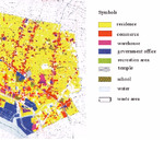
One of the polders is the Sukhumvit Polder. The polder is located in the eastern part of Bangkok. A lot of data was available for part of this polder. That is why one of my PhD students chose this polder for his study on the water management. The part of the Sukhumvit Polder that he studied has a total area of 368 hectares, of which 248 hectares is paved surface – buildings and roads – and 120 hectares is unpaved surface – gardens, parks and public gardens. The most important dimensions of the water management system for this urban polder during his study were as follows: diameter of the sewerage 0.6 metres; distance between the urban canals 600 metres; water level in the urban canals during the wet season 2.10 metres below the surface; area of open water 0.6% of the total area and pumping capacity 13.7 centimetres per day, calculated over the area.
The area of open water in particular was far too small and the pumping capacity was not all that great for the local rainfall amounts. This is also the case in many Asian cities, which causes regular flooding. In addition, the subsidence in many places in the city was around 4 to 5 centimetres per year, which increasingly limited the discharge possibilities to the sea. When flooding occurred again, it was attributed to climate change. Climate change does indeed play a certain role, but this is only limited compared to the above-mentioned factors.
Consideration was given to increasing the area of open water to enable more storage and to limit rapid water level rises. He has analysed various possibilities and their effects. Whether his results have also been applied in practice is unfortunately unknown to me.
In 2011, Bangkok and the surrounding areas suffered major flooding. The dikes and pumping stations were subsequently improved, particularly for various industrial estates. As a result, these areas are now better protected against flooding and the excess water is discharged more quickly. However, one of the consequences of this is that the receiving watercourses cannot store and transport this extra water properly, which means that areas where no improvements have been made will flood even sooner. The coming years will show whether good solutions can be found.


