The Yellow River is 5,500 km long. Because the river flows upstream through a loess plateau, it is the most silty of the major rivers on earth. Over a large length the river flows more or less through a desert. There are several areas here where agriculture is practiced using irrigation water diverted from the river. In the previous decades the size of these areas had increased to such an extent that too much water was withdrawn from the river. As a result, the downstream section of the river was regularly dry. This was the worst in 1997. The river was then dry for 227 days over a length of up to 700 kilometres from its outlet into the Yellow Sea. Best compared to a dry Rhine River from Basel to the North Sea.
While the river is so rich in silt, enormous amounts of silt are deposited downstream and before the mouth. Due to the silt deposits, the bottom of the river is above the ground level of the adjacent area over the last 700 kilometres and the river runs between two high dikes to the sea. At its most extreme section, the river bottom is 14 metres above the adjacent area. When I asked an engineer from the River Commission how they actually determined the height of the dikes in such a situation, he replied that they had not had a dike breach for 50 years and that during high discharges 20,000 people were kept ready in case of to take emergency measures. I really wondered about the usefulness of this, because how can you close a breach in a dike if the river water falls 14 metres like a waterfall when a dike breaks? Interesting problem for dike specialists.
As mentioned, we had to investigate the flooding in the Huinong Irrigation District. This area covers 225,000 hectares - more than twice the size of Polder Flevoland - and is located 3,500 kilometres from the mouth of the Yellow River. In our terms: if we save water, they benefit in Athens. On my first visit to the area I was guided by the excellent Mr. Fang, who had worked in the area for 25 years. He knew the area like no one else. I found that the average annual precipitation was only 19 centimetres. This is not an amount that could give rise to flooding. So I quickly came to the conclusion that too much irrigation water was being given.
Mr. Fang did have data and after an evening of puzzling I came to the conclusion that of the 4.5 billion cubic metres of water that entered the Huinong area per year as irrigation water, about 2 billion cubic metres flowed back to the Yellow River as drainage water. In addition, about a billion cubic metres flowed into the desert. The drainage water that flowed back into the river did not in itself lead to any loss of water, but it did entail high costs. This was because the maintenance of the drains was quite expensive due to poor soil conditions. The water that flowed into the desert caused flooding and the evaporation created large salt plains. This water - almost a quarter of the supply - was simply lost. If this could be prevented, there would be significant water savings. Over the course of four years, we checked in two test areas and with the necessary model calculations whether the above reasoning was indeed correct. This turned out to be the case. We have also worked out what the best water management would be for this area. We found that a water supply of about 3 billion cubic metres per year was sufficient. Our Chinese counterparts agreed with this.
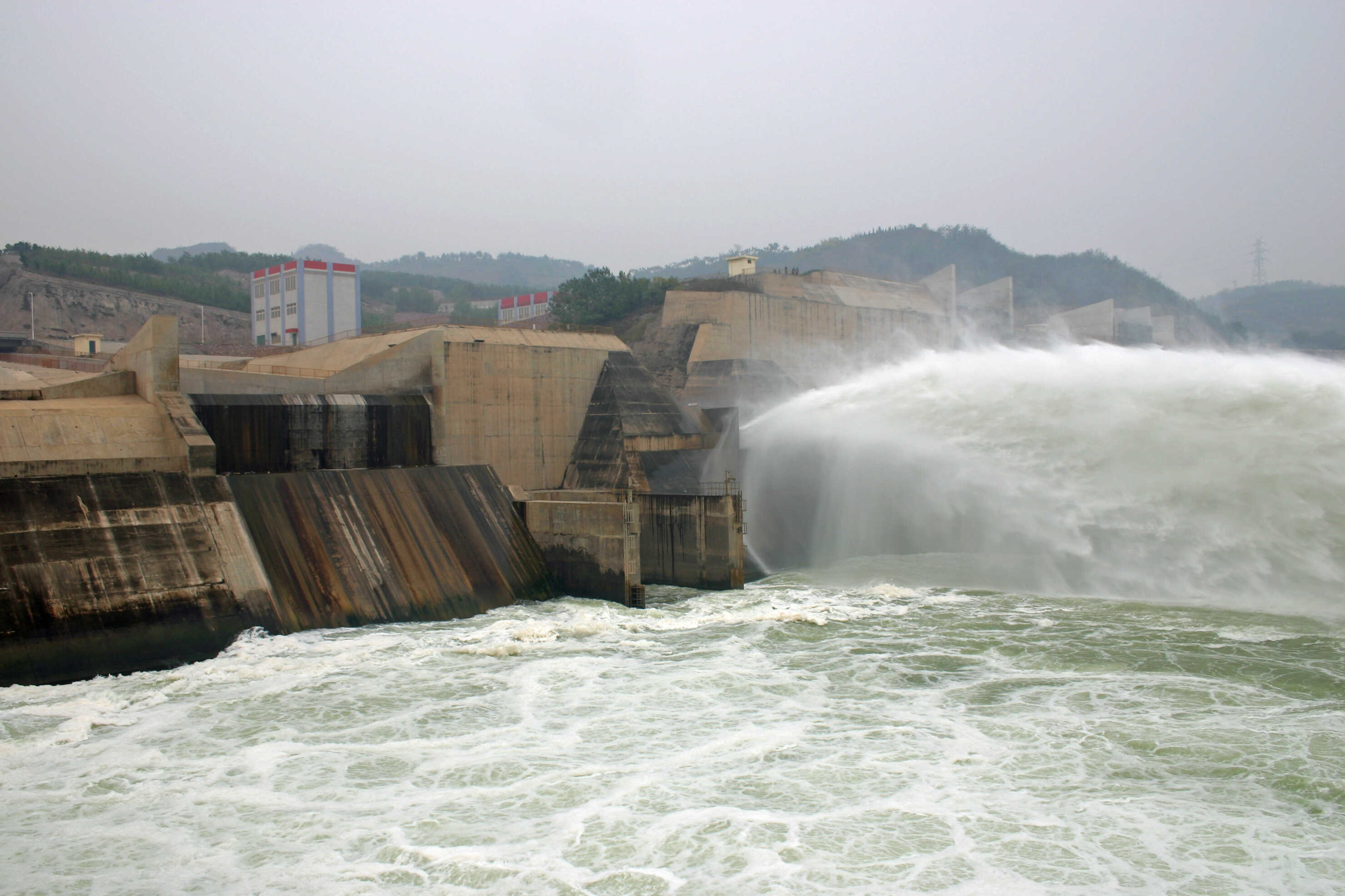
In 2005 and 2007 I visited the Yellow River again in a few places, this time at the Xiaolangdi Dam and the Delta respectively. The Xiaolangdi Dam is located about 700 kilometres from the mouth of the Yellow River and was completed in 2000 to generate energy and store a significant part of the sediment in the reservoir, so that the bottom of the river downstream would not rise further. It is a very impressive dam that can be used for many years to come.
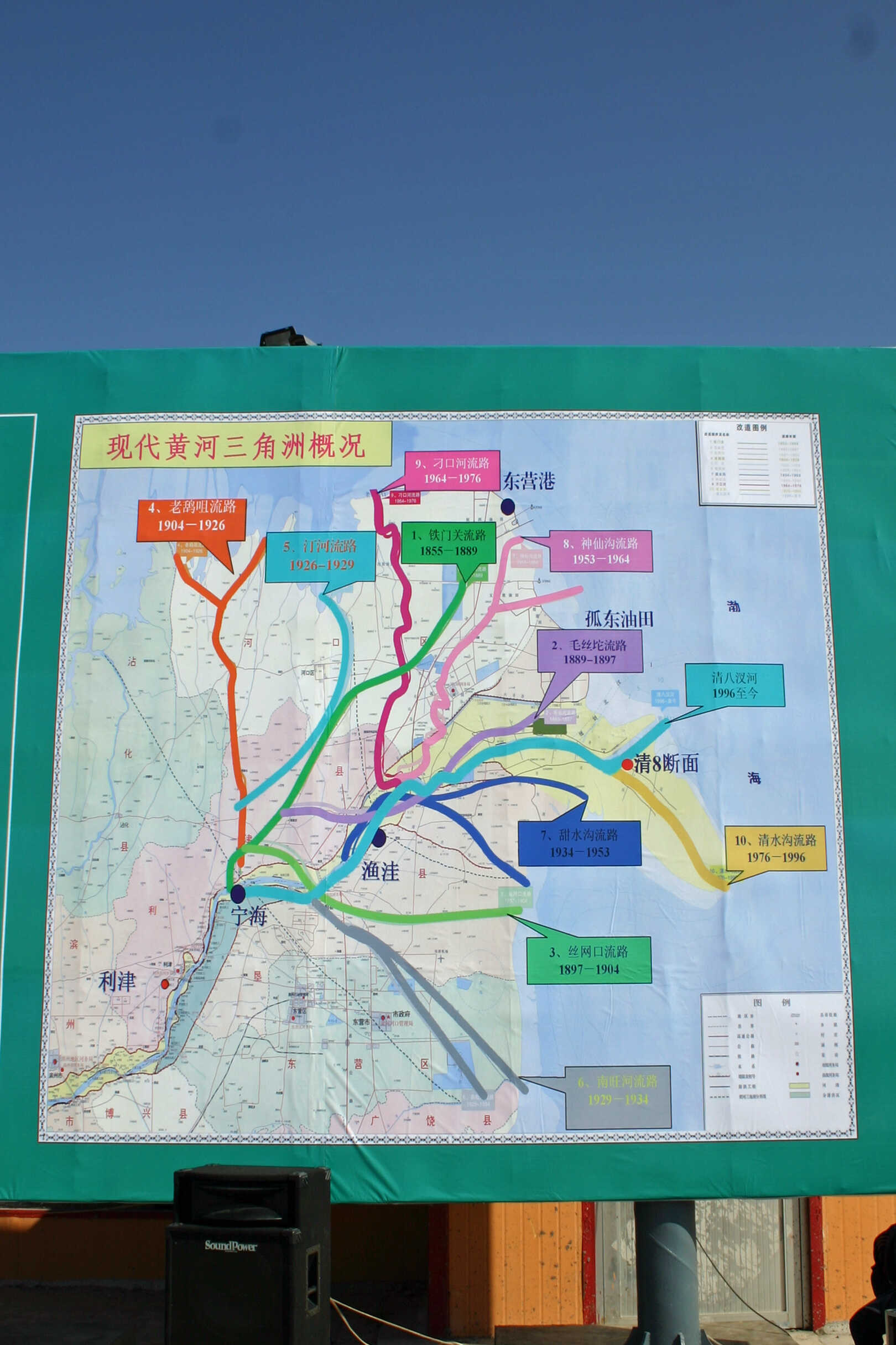
Then the delta, here the river fans out. Because there was so much silt before the construction of the Xiaolangdi Dam, the main arm shifted regularly. This has decreased since 2000.
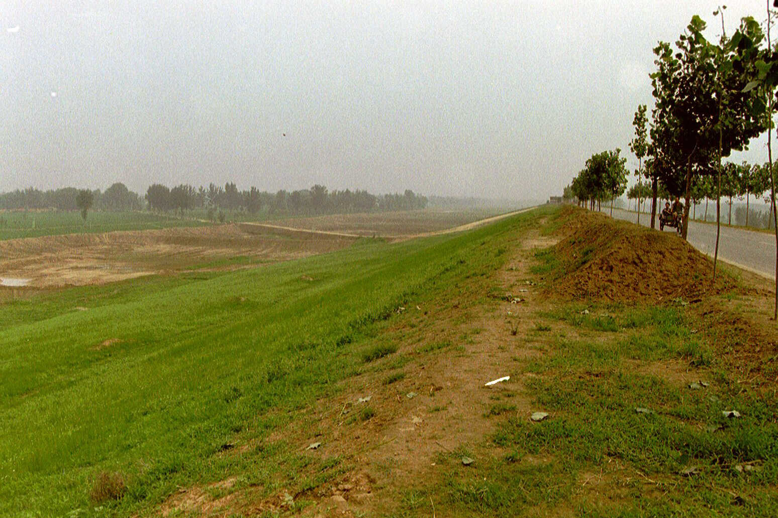
In 2019 I made my last visit to the Yellow River for the time being. We visited the Hetao Irrigation District in Inner Mongolia, which is located downstream of the Huinong Irrigation District on the bank of the Yellow River. This area actually turned out to be a huge polder of 680,000 hectares - almost seven times the size of Flevoland. During our visit, the Yellow River was full of water. The many measures taken over the years have certainly paid off.