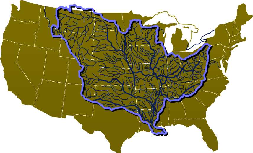
First some key figures. The Mississippi River provides the drainage for almost half of the United States and also for a small part of Canada. The well-known major tributaries are the Missouri, the Ohio, the Tennessee and the Arkansas. The total area of the river basin is 3.25 million square kilometres, approximately ninety times the size of the Netherlands. The average discharge at the mouth is 20,000 cubic metres per second. During peak discharges, approximately 36,000 cubic metres per second flows into the Caribbean Sea. For comparison, the Room for the River project is based on a discharge of the Rhine at Lobith of 16,000 cubic metres per second.
Because the Mississippi River transported considerable amounts of sediment in the past, the delta has expanded considerably, which can be beautifully seen from the air or on aerial photographs. The land area of the Delta is therefore approximately 18,000 square kilometres. However, around the end of the nineteenth century, a change occurred and since then, the Delta is reduced approximately 62 square kilometres in every year due to erosion.
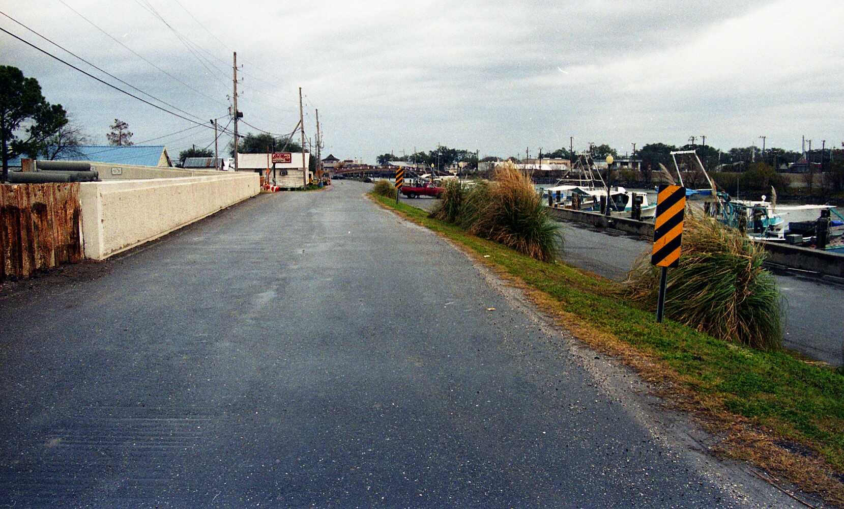
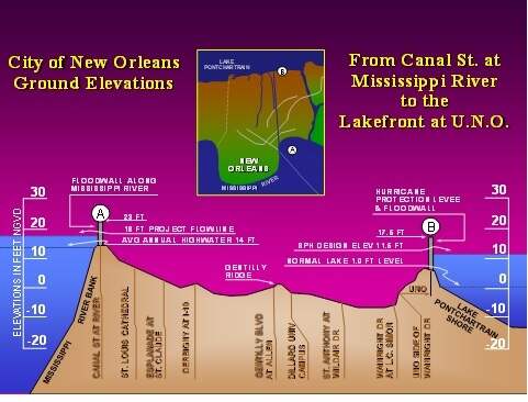
Major causes of land loss are the hurricanes that hit the area from time to time. In addition, land subsidence occurs. The most subsidence has occurred in New Orleans - 1.1 million inhabitants - where in 2003 the deepest parts were almost at 3 metres below mean sea level. A real urban polder with a very large pumping capacity.
A lot of research is being done into possible flooding by hurricanes. It is virtually impossible to predict whether these will hit the area or not, but if a serious hurricane occurs, there will be more than 8 metres of water in the area near New Orleans, because the dikes are not designed for this. Moreover, there is enormous damage due to the wind. The last major flood in the 20th century was in 1965 due to Hurricane Betsy. This century saw the flooding caused by Hurricane Katrina in 2005. In 2008, things went well during Hurricane Gustav, because this hurricane turned left at the last minute and therefore made landfall west of the Delta.
During a flood, some of the water flows away automatically after the hurricane. However, the last 2.5 metres must be pumped out. At that time, the pumping stations could pump out a water layer of 30 centimetres per day from the area. If the dikes have been closed again and the pumping stations have not been damaged too much, it will take about eight days before the land resurfaces. By that time the damage to houses, buildings and roads is incalculable. This unfortunately occurred during the floods in 1965 and 2005.
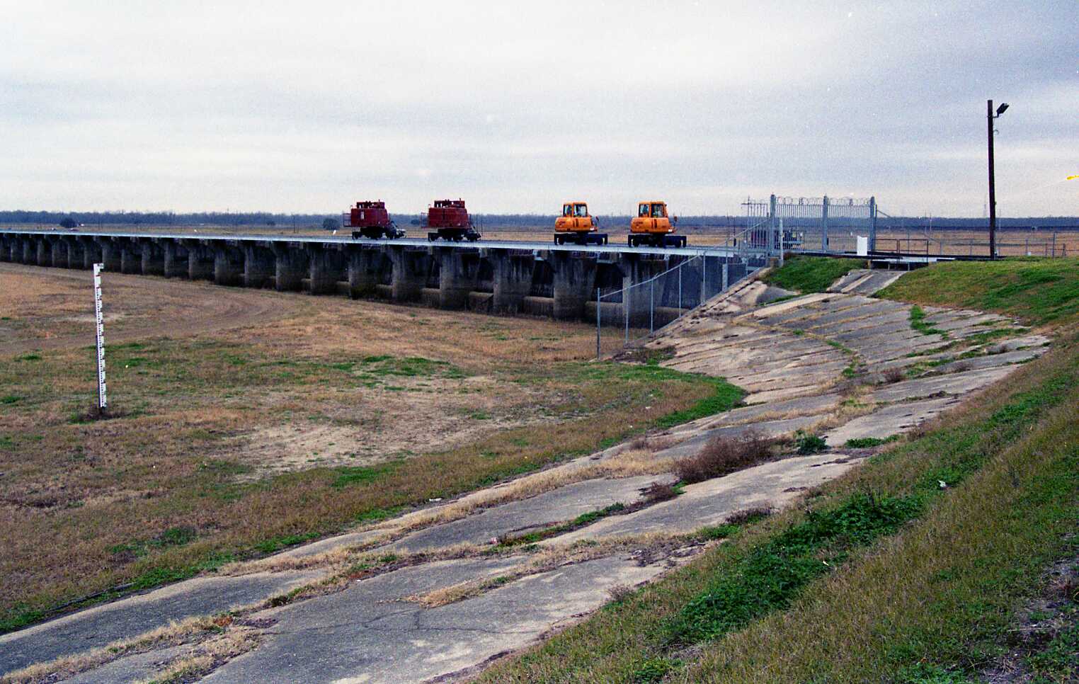
Floods from the Mississippi River are easier to predict. Upstream of New Orleans is a huge 'green river' between two dikes, along which during peak discharge approximately 20% of the Mississippi's discharge can be diverted via the Bonnet Carré spillway to Lake Pontchartrain on the east side of New Orleans and from there to the Caribbean Sea. This 'green river' was constructed in 1931 and has since been used 12 times, preventing a flood. This spillway has therefore more than generated its cost.
The problems will only increase in the future as the country continues to sink. Increasingly expensive measures will therefore have to be taken to protect the land against flood water.