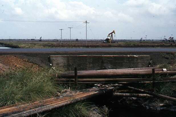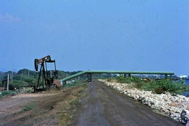
Due to the shallow extraction, there is a lot of land subsidence, which in the most affected areas will amount to a total of approximately 10 metres. When oil extraction started around 1920, the land surface was approximately 2 metres above mean sea level. When oil extraction will be completed, the land surface at the deepest points will therefore be approximately 8 metres below mean sea level. Due to the subsidence and the dikes, three polders have been developed next to each other along the coast - Tia Juana, Lagunillas and Bachequero - each in the shape of a semicircle with the coast as a straight line. In total, they cover approximately 19,000 hectares.
Traditionally, NEDECO (Netherlands Engineering Consultants) advised on the security (dikes) of the area and water management. Around 1980, flooding occurred regularly, and it was felt that a Drainage Masterplan was needed. I was brought in as supervisor for the preparation of this masterplan. This meant that I spent a week in the area in all draft stages of proposals and reports to view and discuss the various matters. The actual plans were made by a Venezuelan consulting firm and NEDECO. The client was the State Oil Company Maraven, which was responsible for the safety and water management in the area.
In 1982 I made my first visit. At the deepest points, the land surface was already 5 metres below mean sea level. I was told that there had been a lot of flooding. I asked if they had aerial photographs showing where the flooding was taking place. Well, they did, because I had no complaints about data. In the photos I saw that the flooding was in the corners of the rectangular areas bounded by roads. I asked if they knew if the roads were higher and this turned out to be the case. The next day we went into the field. Then the matter quickly became clear. You can also lay oil pipes very well through a culvert under a road. This was also done on a large scale, which caused many culverts to be blocked for the water flow.
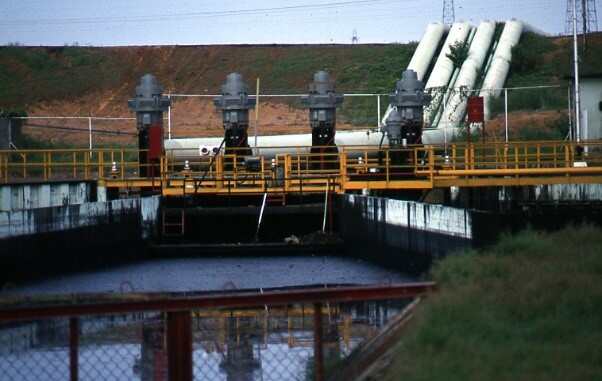
Another cause for the flooding that was mentioned was that the electric pumping stations would not be able to process the water. The pumping stations started automatically when the water level rose to a certain level and stopped when the water level was low enough again. The Tia Juana polder had by far the largest pumping capacity per unit area. The remarkable thing, however, was that Tia Juana suffered the most from flooding. I went to look with them in the field again. I noticed that the drains to the pumping stations were rather narrow and began to suspect that the problem was not with the pumping stations, but that the drains were simply too small to get the water to the pumping stations, so that they kept shutting down after they had pumped out a small amount of water. I did a small calculation about this in the evening and presented it the next day. They had never thought that this was the problem and had kept adding capacity to the pumping stations.
In broad terms, it was clear to me what the problems were and the work on the Drainage Master Plan could begin. After about two years, we had the entire plan ready, including the consequences for operation and maintenance. The plan, including 25 years of operation and maintenance, was going to cost about 50 million US dollars. We cautiously presented this consequence to the gentlemen at Maraven. They did not bat an eyelid at the amount and after some discussion told us that it corresponded to the income from one day of oil production. They were therefore very happy that they had settled the matter for about 25 years for this, in their eyes, small amount.
A few years ago, I was called while there was flooding again in the area and whether I would be available to advise. They were talking about more precipitation due to climate change. I advised them to first check whether oil pipes had been laid through their culverts again. This was probably the case, because I was not called again.