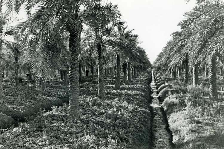
Since this must have happened mainly in the area near the Persian Gulf, there may also have been some form of drainage. It is known that irrigation was applied here around 4000 BC in the place Eridu. This was probably one of the first applications of irrigation in the world. The first polders were probably also reclaimed in this area. However, as far as I know, it is not exactly known when this occurred.
Today, there are still polders in this area. An example of this are polders for the cultivation of date palms on the island of Abadan, which lies in the river Shatt al-Arab (called Arvandrud in Persian). Abadan lies in the lower delta of the Euphrates, Tigris and Karun rivers. The eastern part of the island consists of marshes that lie about two metres above mean sea level. However, the reclaimed areas have an altitude that is close to mean sea level. More generally, agriculture can be found along the banks of the rivers in the delta. Due to the low altitude, especially close to the rivers, the farms are often protected from flooding by dikes.
The palm trees are traditionally irrigated by a system of tidal canals, from which river water is admitted into the area at high tide and infiltrates into the soil. The belt of palm trees extends over a distance of approximately forty kilometres along the river branch where the Euphrates and the Tigris meet. The width of the belt varies from two to six kilometres. In the upper part of the belt, the tidal water almost never floods the land. In the middle part, there is a transitional situation. In the lower part, the non endiked land is more often flooded and the water is salty. The tidal canals are endiked and houses are built on mounds.
The tidal fluctuation in the estuary is between 1.7 and 1.9 metres and gradually decreases upstream. In the past, the river discharge was considerably higher in winter and spring than in summer and autumn. The slope of the water level along the length of the river was therefore steeper and the water level higher. Although the reduction of the flood wave is more pronounced at high discharge, the higher river level compensated for this completely.
In the past decades, there has been a huge development of irrigation in the upper reaches of the Euphrates and Tigris rivers. As a result, the discharge in these rivers has decreased considerably in the middle and lower reaches. This has led to a considerable decrease in the availability of irrigation water and for the polders to a lower risk of flooding. The coming period will have to show how the situation will further develop.


