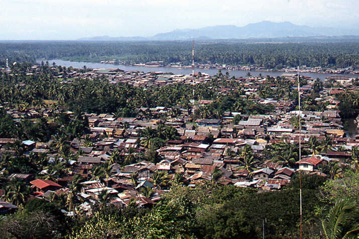
The city, which is located about six kilometres from the coast, suffered quite a bit from waterlogging and flooding. This could be caused by the tides from the sea penetrating the rivers, causing high and low tides twice a day. Some low places in the city and in the entire delta were flooded daily or twice a month during spring tides. During wet periods, flooding could be greater due to high river discharges.
In other parts of the city, flooding was a regular occurrence, mainly due to the inadequacy of the urban drainage system to drain excess water during heavy rains. The problem was further aggravated by the dumping of solid waste in the canals, clogging, and uncontrolled growth of residential areas and slums. The rivers and creeks served as natural outlets for the urban drainage system. A master plan for the city's water management was developed to map out the necessary improvements.
At the request of the mayor to the Netherlands Ministry of Transport and Water Management, I visited the city together with a colleague from Rijkswaterstaat in January 1994 to view the situation and make recommendations in connection with the master plan to be drawn up. We were received excellently and shown around to all relevant points. We flew over the area and sailed over the river and along the coast. We had constant supervision during these trips, because as foreigners we apparently could take quite a few risks.
The big question was what caused the flooding in the different places. To gain insight into this, we asked for surface level data. These were not really available and nobody knew how we could get them. There was a global map, but what the levels on it meant in relation to the average sea level was not very clear. Eventually we found an old man who had worked on level measurements by the Americans in the sixties. He could tell us exactly what was going on and that helped us a lot.
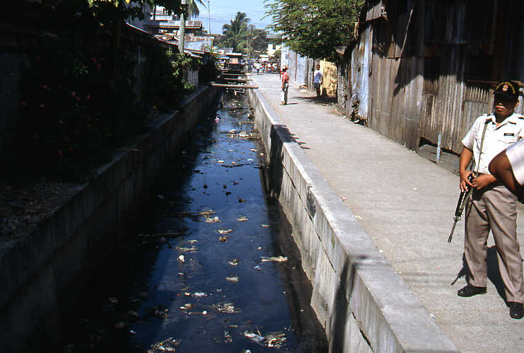
There was considerable water pollution in the river and estuary. Water-related diseases were common. This was mainly caused by the fact that there was no sewerage system. There were plans to tackle the sewerage and the city was selected as one of five cities in the Philippines where sewerage would be installed with a loan from the World Bank. The drinking water supply was better, but also left much to be desired in several places.
Cotabato City was intended to grow further and enhance its status as a regional commercial centre, which it did, given the aforementioned population increase. A New Town in the Delta was also projected, which would be connected to the city by a 4 kilometre long access road.
The above meant that the city government was faced with problems due to the location of the city in the flood prone delta and the waste and wastewater production in the city itself, while the city was growing rapidly. In this connection, it was important to approach urban drainage and flood control, drinking water supply, sewerage, and solid waste collection and disposal as a single coherent package within the framework of urban development planning. It was therefore also advisable to integrate the water management master plan that was being prepared into the urban development master plan. Such a plan was of great importance, since the costs of urban drainage and flood control would constitute a substantial part of the total development costs of the area. Good drainage and flood control of urban development and valuable sites would be decisive for successful economic growth.
Therefore, it was first necessary to have a detailed insight into the geographical situation, including all relevant aspects such as road elevations, construction and paving, depressions, drains, etc. In order to obtain this insight, we recommended purchasing a Geographic Information System (GIS) - which was still in its infancy at the time - and training personnel to work with such a system. For the development of a lowland area, such a system has now become indispensable.
Based on our findings, we presented our conclusions and recommendations to the mayor and his staff at the end of our visit and later recorded them in a report. Some could be implemented immediately if the city council considered them appropriate, most others could be focal points in the water management master plan or in the urban development master plan.
As mentioned, flooding could be caused by the tides, by a combination of tides and a large river discharge, or by rainfall. In the first two cases, the surface level was usually relatively high above average sea level, but not high enough to withstand extremely high water levels. An obvious solution here was to build a dike along the river. In order to guarantee the drainage of rainwater from the protected area, improvements to existing or construction of new watercourses and storage ponds were then necessary. Where the watercourses crossed the roads, good culverts or bridges had to be present. Where watercourses crossed the dikes, flapgate culverts had to be constructed to prevent the inflow of water from outside.
In the case of flooding due to rainfall, the limited discharge of excess water to the rivers was the problem. The frequent flooding in the city was mainly caused by this. Improvement of the drainage system was therefore necessary in several places. In some cases, the drainage situation was so poor that even after long dry periods, the excess water could not be discharged to the river. In those cases, there were basically three solutions, namely: drainage by pumping, raising the area to a level well above the expected maximum high water, or giving the area a special function, such as a city park with a pond.
As for the roads that would connect the New Town with Cotabato City, careful planning of the location was required, because these roads would also serve as a local dike. In order to prevent erosion, sedimentation and pollution problems, it was necessary that the roads would affect the watercourse system as little as possible. A good phasing of the construction of the road network could be achieved by, for example, developing the upstream part of the delta first. In this way, a large part of the flooding could be brought under control quickly.
The surface level at the location of the new city to be built in the delta was so close to the average low water levels that drainage by gravity would not be technically feasible. Also in view of the risk of tsunamis, we recommended raising the area integrally. A polder was considered too risky by us.
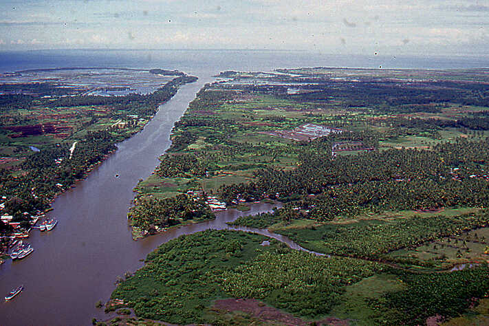
A few years before our visit, the Rio Grande de Mindanao River, which meandered from the city to the sea through the coastal plain, had been straightened, which had clearly resulted in less flooding for the city. There was now a plan to dredge the Rio Grande de Mindanao upstream of the city, some 50 kilometres inland. The mayor presented the plan to us with some pride. We told him that this would be very risky for his city, because the water would then come down more quickly and probably could not be drained sufficiently further to the sea. He looked at us in surprise, but he understood it immediately. He said:
“I have discussed this plan with forty engineers and no one has pointed this out to me, but you are right.”