The lowest area is now in the Zuidplas Polder northeast of Nieuwerkerk aan de IJssel at approximately 6.76 metres below NAP. During heavy storms on the North Sea, the difference between the lowest land and the sea level can be more than ten metres. In the event of a possible flood from the Rhine River at the Betuwe region, large differences in level can also occur.
Human intervention in natural conditions began about ten centuries ago. Due to the specific circumstances, there was a continuous interaction between natural developments and human intervention. In order to keep the subsiding land with a rising sea level liveable, more and more and new interventions were and are necessary. Due to these interventions, the Netherlands has gone through a number of processes. Physical processes concern land subsidence and sea level rise. In addition, the socio-economic processes in the form of population growth, the increase in the level of prosperity and the enormous increase in investments in buildings and infrastructure in the low-lying part of the country, as well as care for the environment, are no less important.
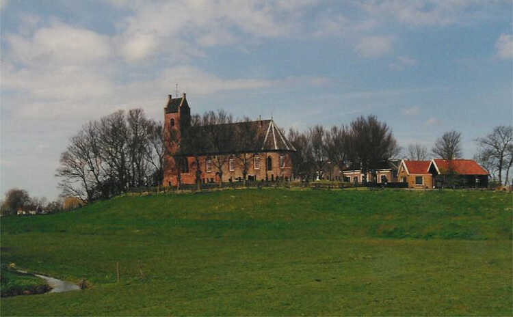
Before humans began to intervene, the low parts of the Netherlands were predominantly covered by peat layers with an elevation of two to three metres above NAP. Since the ninth century, a number of stages have been gone through. These include:
- drainage;
- passive defence – artificial mounds;
- active defence - dikes, drainage and land reclamation;
- water quantity management - water level management, drainage and flood protection;
- water quantity and water quality management - water level management, drainage, waste water treatment and increased flood protection;
- integrated water management - ecosystem management.
We are now in the latter stage. However, another step is being taken to arrive at an integrated environment management, in which spatial planning, environment, water management and flood protection are integrated. The Environment Act, that has been adopted in 2024, has initiated this development.
The key to the development of the low part of our country therefore lies largely in water management and flood protection. Without the complex, historically developed water management infrastructure with the associated administrative and legal instruments, it would not be possible to live and work here successfully. From a technical point of view, it is important that the level of water management in the polder areas is determined by the flood protection provisions and the water management systems. The water management systems were usually primarily for water management in the agricultural area. In addition, separate systems can be distinguished for the sub-areas - urban areas, forests and nature reserves. Over the centuries, the primary functions have been the storage and drainage of water. In the most extreme case, the excess water from the polders now passes four pumping stations before it is discharged into the sea. In the period when pumping took place through series of windmills, there could even be four windmills in a series and a sluice for the final discharge.
The water management systems generally consist of a drainage system – open or sub-surface field drains, collector drains, submain and main drains, and a discharge sluice or pumping station. The systems have characteristic elements, which determine their functioning both by their dimensions and by their mutual coordination. Initially, the water management systems must have been constructed on the basis of practical experience. Since the beginning of the nineteenth century, there has been a certain standard setting and, in particular, the water management systems for new polders have been designed on the basis of standards that have often been established empirically. Empirical standards are also used in land consolidation and land development projects on the basis of which the water management systems are improved. The same applies to the design of systems for urban expansion, forests and nature reserves.
Especially due to the recent dry summers, there has also been more attention for problems with drought. A distinction must be made here between the problems in the high part and the low part of the Netherlands. In the high part there are often drought-sensitive soils, where it is usually difficult to supply water by natural means in case of shortage. Artificially pumping surface water or groundwater is usually a costly affair. In the low part, due to the low location, there are usually better possibilities to supply water artificially. Water storage in the IJsselmeer plays a key role in this.
The first clear drought problem occurred during the dry summer of 1976, when there were also quite a few problems with water shortages in the low part of the Netherlands. This led to the so-called Policy analyses of water management for the Netherlands (PAWN) study by the Rand Corporation from the United States. This study led, among other things, to the realization of a water supply system from the IJsselmeer through the Markermeer to the west of the Netherlands to supplement the water shortages that occurred there. After the dry summer of 2003, a few improvements were made to this system. As a result, and by temporarily raising the water level in the IJsselmeer in spring, no major problems actually occurred in the low part during the dry summers of 2018, 2019 and 2023. The problems were mainly in the high part. Possible solutions are now being implemented there.
Reclamation
Until around 800, the main processes that determined the structure of the landscape were peat formation and sedimentation and erosion by flooding from the sea and the rivers. Both directly behind the closed coast and in the South and East there were many areas with stagnant drainage. This was an ideal situation for peat formation. Extensive peat areas covered large parts of the country.
In the centuries after 800, man became the most determining factor. The peat areas behind the coast were made cultivable by simple drainage ditches. As a result, peat formation stopped and the soil of the cultivated peat areas dropped considerably. The low-lying areas became vulnerable to flooding by sea and river water. Between 800 and 1250, there was therefore an enormous loss of land. Large areas in the North and in the Southwest were lost. Many areas along the coast subsided by several metres due to exploitation. This subsidence made large areas accessible to the sea by the tide. The sea inlets began to scour out to be able to supply the larger tidal volume. This also gave the sea easy access to the now low-lying land. Storm surges that could easily penetrate through the widened and deepened sea inlets accelerated the process of increased sea influence.


